 Monthly payment from
 CHOOSE THE RIGHT PATH AND STAY IN TOUCH WHILE CAPTURING YOUR ADVENTURES

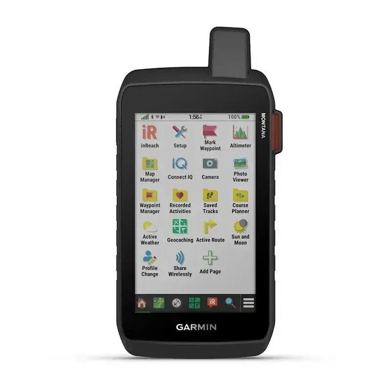
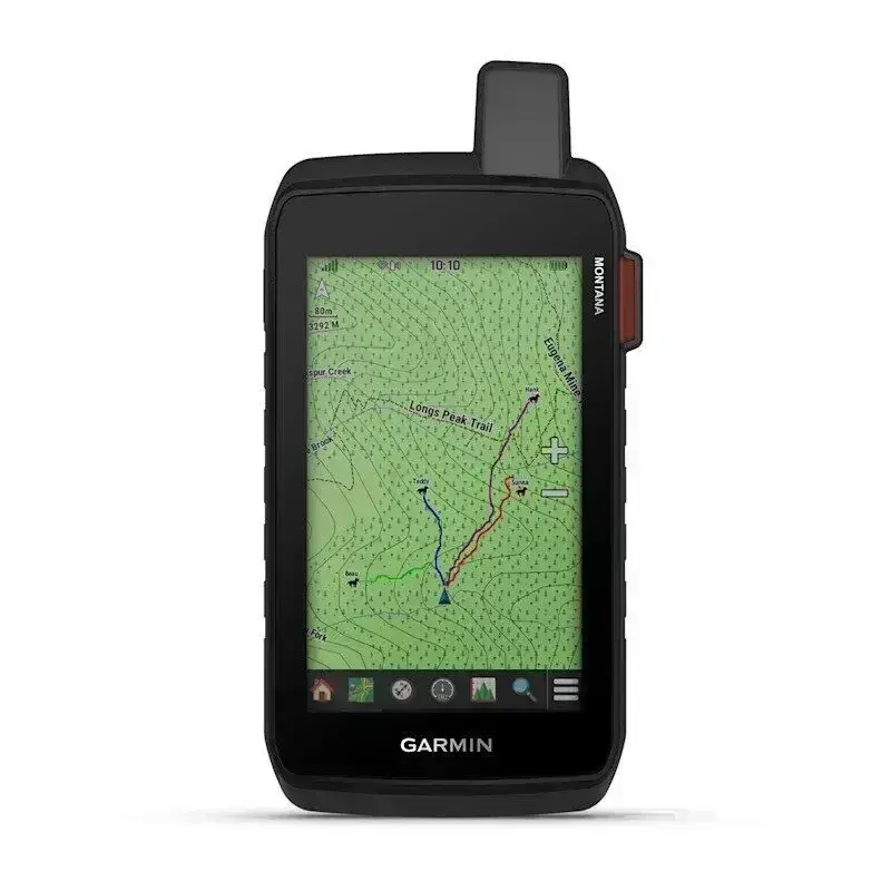
LARGE 5″ TOUCHSCREEN, GLOVED

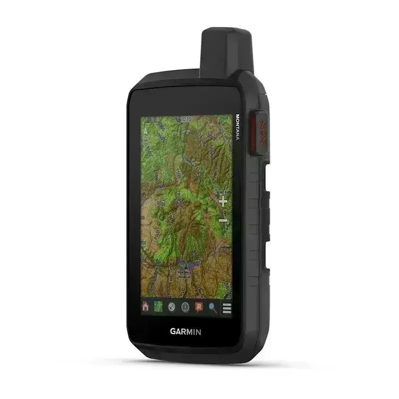
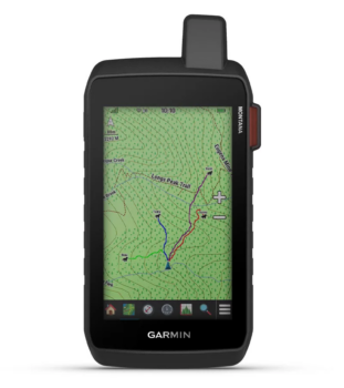
PRELOADED ROUTABLE TOPOGRAPHIC MAPS WITH LANDMARKS

USE THE BUILT-IN CAMERA TO TAKE PHOTOS AND MARK YOUR LOCATION

SEE AERIAL PHOTOS OF THE ROUTE IN THE SATELLITE IMAGE GALLERY

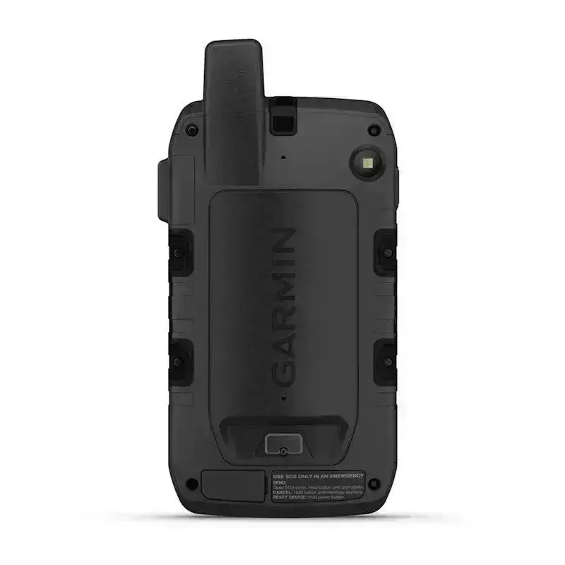
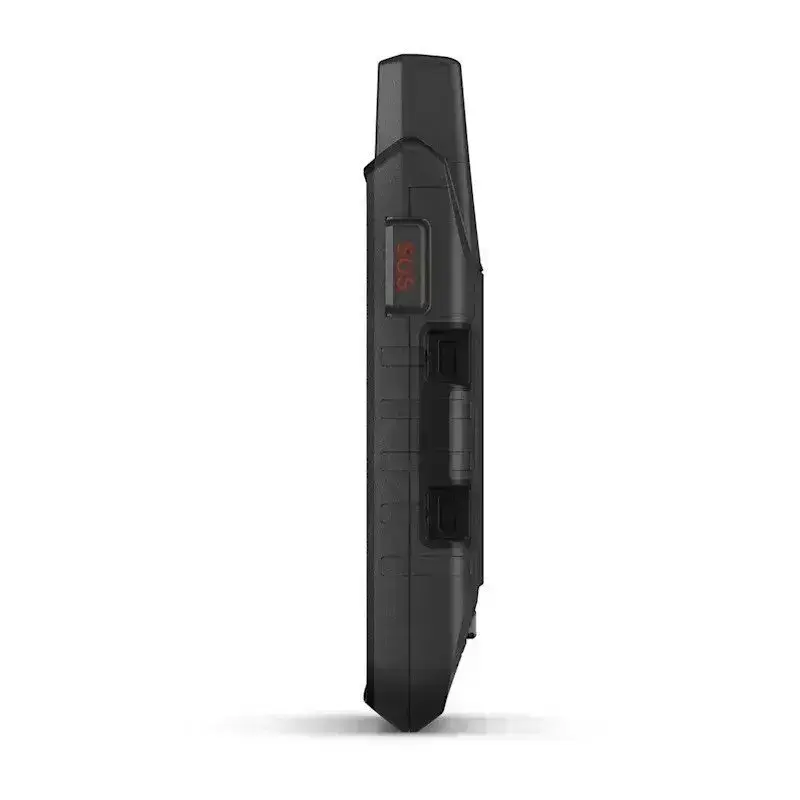
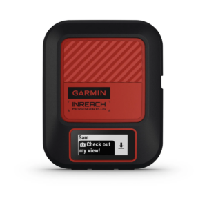
STAY REACHABLE WITH INREACH MESSAGING AND SOS1 24/7
YOU’LL LOVE IT
GLOBAL CONNECTIVITY
With an active inReach subscription, you can stay connected even when your adventures go off grid. Instead of relying on cellphone coverage, now your messages, SOS and tracking are transferred via the 100% global Iridium® satellite network1.
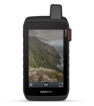
BUILT-IN CAMERA
Capture your adventures with the built-in 8 megapixel autofocus camera of this Montana 760i. It places geo-tags with coordinates in your photos, so you can navigate back to your favourite spots in the future.
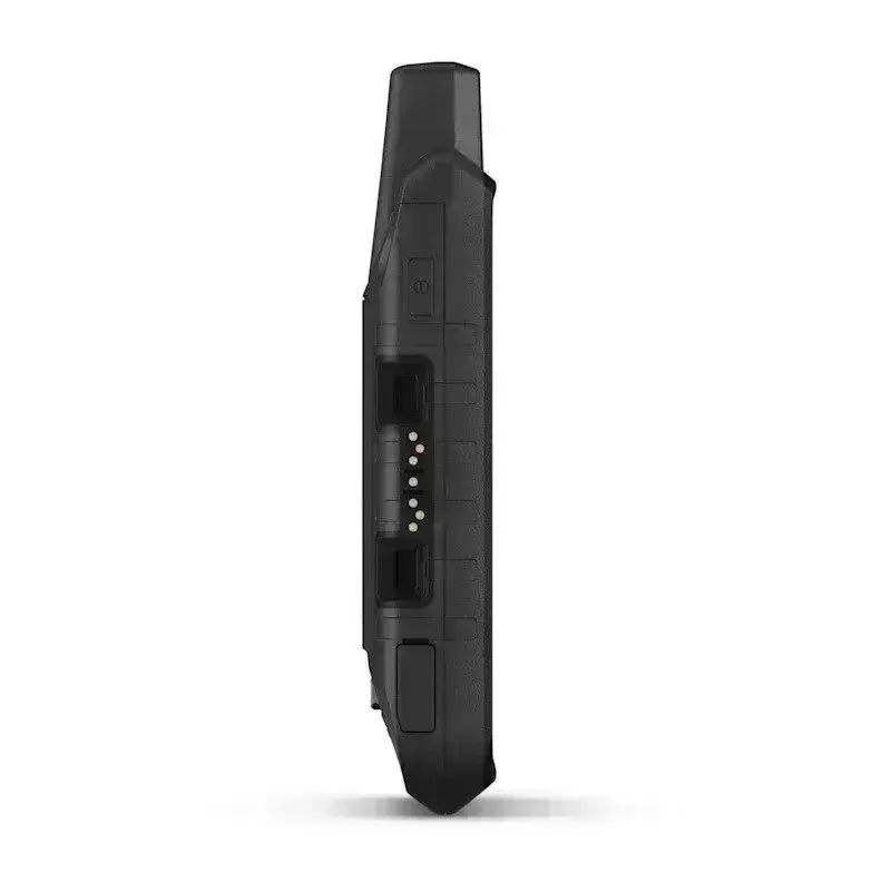
ROBUST CONSTRUCTION
This reliable, water-resistant portable device has been tested to MIL-STD 810 for thermal, shock, water and vibration. It has a 5-inch touchscreen for use with gloves and is compatible with many different types of mounts (sold separately), tailored to your activities.
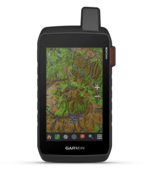
TOPOACTIVE MAPS
Use pre-loaded topographic maps to find your way on your adventures . Explore contours, elevations, coastlines, rivers, landmarks and more.
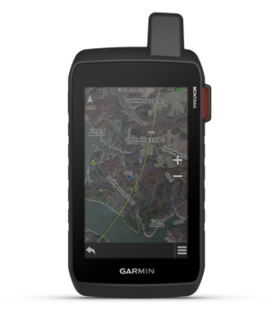
SATELLITE VIEWS
Access a gallery of high-resolution satellite images and download them directly to your device via a Wi-Fi® connection without a subscription fee. See photorealistic views of routes and surrounding terrain and easily create waypoints by following landmarks.
OUTDOOR MAPS+
Add an Outdoor Maps+ subscription (sold separately) and get uninterrupted access to a wide range of premium mapping content, as well as regular updates directly to your Garmin device via Wi-Fi.
EXPLORE THE WORLD. DON’T LOSE TOUCH WITH HOME.
INREACH FUNCTIONS

TWO-WAY MESSAGING
Exchange text messages with loved ones back home, or communicate via inReach device to inReach device in the field1.

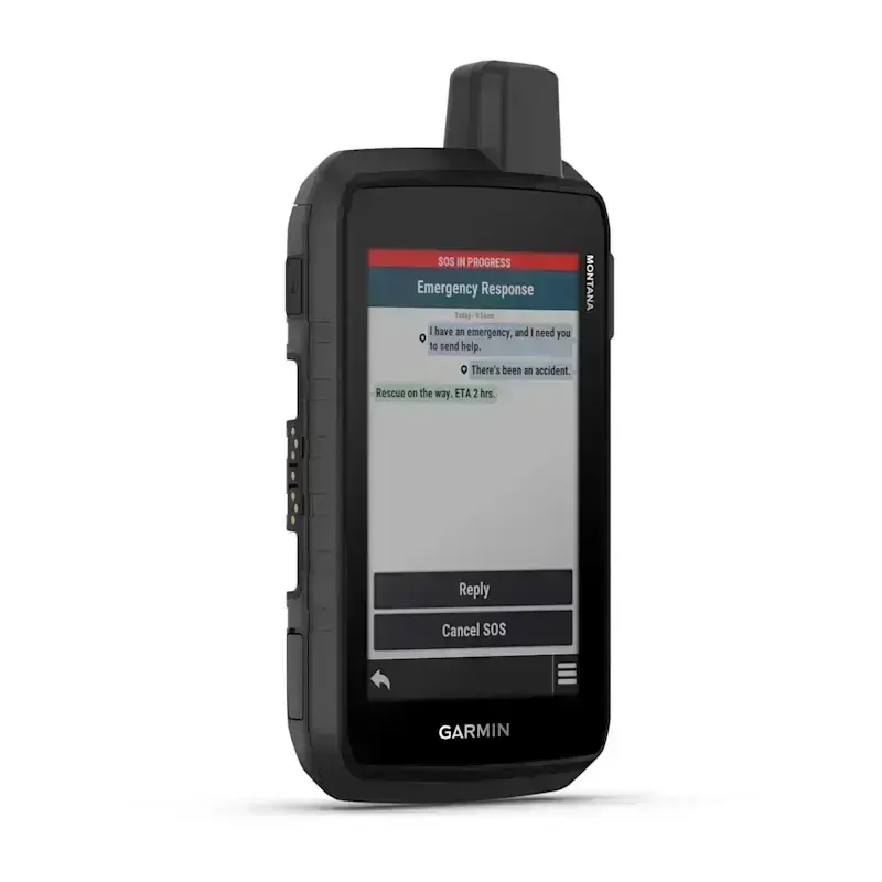
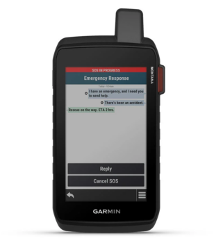
INTERACTIVE SOS REPORT
In case of emergency, trigger an interactive SOS message to Garmin ResponseSM, a 24/7-staffed professional emergency response coordination center1.

INREACH WEATHER DATA
Available inReach weather forecast service provides detailed updates directly to your Montana handheld or paired devices, so you’ll know what to expect en route1.

LIVE TRACKING
Using your live tracking page, followers can see your progress, ping your device to see your GPS location and exchange messages during your trip1.
NAVIGATION FUNCTIONS

GARMIN EXPLORE™ APP
Pair with the Garmin Explore app to plan and review trip data, manage waypoints, routes and activities.

MULTIPLE GNSS SUPPORT
Access to the GPS and Galileo satellite networks allows the Montana 760i to navigate in more complex environments than with GPS alone.

ABC SENSORS
Take to the next trail using ABC sensors including an altimeter for altitude gain data, a barometer for weather monitoring and a 3-axis electronic compass.

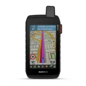
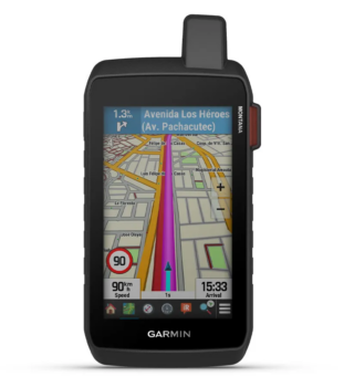
CITY NAVIGATOR® MAPS
Seamlessly switch from trails to road navigation with the pre-loaded European City Navigator street map, which guides your journey with easy-to-read turn-by-turn directions.

ADDITIONAL CARDS
The 32 GB built-in memory allows you to load more cards, such as BlueChart® g3 water cards (sold separately).

WEATHER FORECAST
Access the latest weather forecasts with the Garmin Connect™ app on your compatible smartphone


WIKILOC TAKAS
This pre-loaded app makes it easy to download hiking, cycling and other Wikiloc trails shared by outdoor enthusiasts like you. Get a free 60-day trial of Wikiloc Premium to try these and other exclusive features. Find out more.
ADVENTURE FEATURES

EXPEDITION MODE
Go far off the beaten track. Use the optimisation mode, which provides GPS directions with very low power consumption. This way you can use your Montana device for more than two weeks without additional charging.

BATTERY OR BATTERIES
A built-in lithium-ion battery provides up to 24 hours of battery life in GPS mode and is rechargeable with a standard USB-C® cable.

VEHICLE ANCHORAGES
A variety of Montana handheld mounts (sold separately) allow you to adapt your navigation device for use on ATVs, boats, cars, motorcycles, camper vans or other vehicles.
1 Active satellite subscription required. In some jurisdictions, the use of satellite devices is regulated or prohibited. It is the user’s responsibility to check and comply with all applicable laws in the jurisdictions where the device is to be used.
Wi-Fi is a registered trademark of the Wi-Fi Alliance. USB-C is a registered trademark of the USB Implementers Forum.
Engineering improvements are ongoing and may not be reflected in images, videos and specifications.
Reviews
There are no reviews yet.